Interpreting Plans and Elevations of 3-D Shapes
Plans and elevations are used to represent three dimensional shapes using two dimensional drawings. Being able to interpret these views allows you to understand the shape, size and structure of an object.
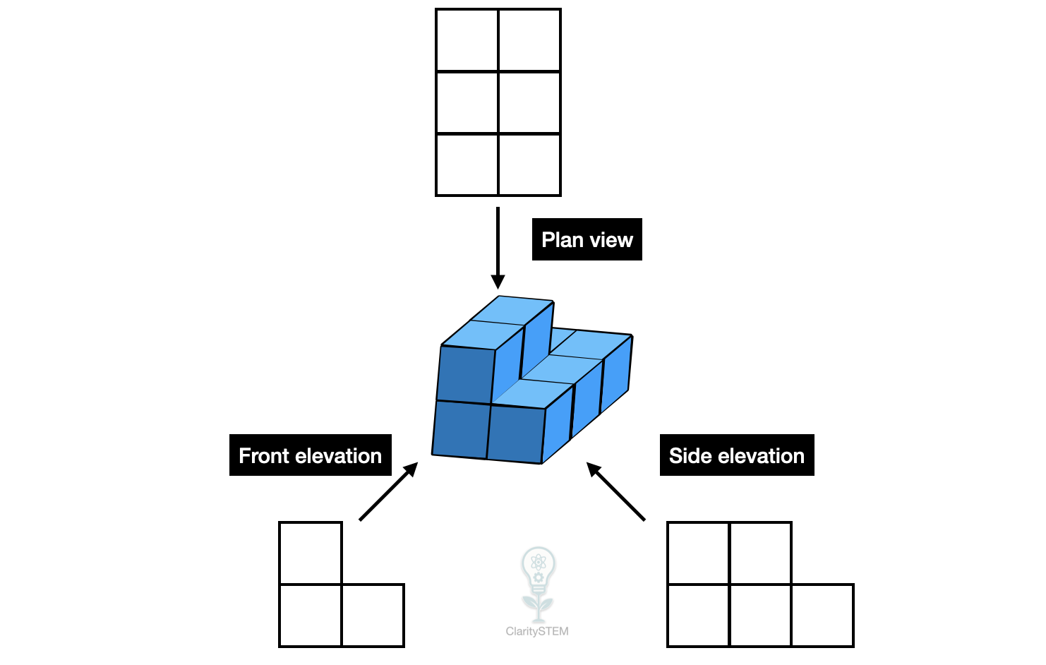
What Plans and Elevations Are
A plan is a view of a 3-D shape from directly above.
An elevation is a view of a 3-D shape from the side or front.
Each view shows only two dimensions at a time, but together they give a full picture of the object.
Common elevations include:
• front elevation
• side elevation
The height of the object is only shown in elevations, not in the plan
Interpreting a Plan
A plan shows the length and width of a shape.
From a plan you can:
• see the outline of the shape from above
• identify the position of features such as holes or steps
• compare widths and lengths
Hidden parts below the top surface are not shown in a plan.
Interpreting an Elevation
An elevation shows the height of the shape and one other dimension.
From an elevation you can:
• see how tall the shape is
• identify vertical faces
• recognise steps or changes in height
Different elevations may look different depending on which side is viewed.
Using Multiple Views Together
To understand the full shape, plans and elevations must be considered together.
For example:
• the plan shows the footprint of the shape
• the front elevation shows height and width
• the side elevation shows height and depth
Matching dimensions across views is essential.
A feature seen in one view must align with the same feature in the other views.
Common Interpretation Tasks
You may be asked to:
• match a 3-D shape to its plan and elevations
• describe a 3-D shape using given views
• count faces, edges or vertices using the views
• identify missing views
Careful comparison helps avoid mistakes.
Common Errors to Avoid
Common mistakes include:
• confusing width and depth
• ignoring height differences
• assuming hidden features are visible
• not matching dimensions between views
Always label views clearly and read scales if given.
Key Points to Remember
A plan is a view from above.
Elevations are views from the side or front.
Plans show length and width but not height.
Elevations show height and one other dimension.
All views must be used together to understand the full shape.
Interpreting plans and elevations allows three dimensional objects to be understood clearly from two dimensional drawings.